Showing 145–162 of 171 results
Regional Postcode Address File (PAF) Midlands
This instant download contains all Postcode Address File (PAF) addresses / delivery points in the Midlands. That’s every known address and postcode in the 10 Postcode Areas B, CV, DE, DY, LE, NG, NN, ST, WS and WV. Addresses are updated...
Download Now
Regional Postcode Address File (PAF) North East
This instant download contains all Postcode Address File (PAF) addresses / delivery points in North East of England. That’s every known address and postcode in the 16 Postcode Areas BD, DH, DL, DN, HD, HG, HU, HX, LN, LS, NE, S,...
Download Now
Regional Postcode Address File (PAF) North West
This instant download contains all Postcode Address File (PAF) addresses / delivery points in the North West of England. That’s every known address and postcode in the 16 Postcode Areas BB, BL, CA, CH, CW, FY, L, LA, M, OL, PR, SK,...
Download Now
Regional Postcode Address File (PAF) Scotland
This instant download contains all Postcode Address File (PAF) addresses / delivery points in Scotland. That’s every known address and postcode in the 16 Postcode Areas AB, DD, DG, EH, FK, G, HS, IV, KA, KW, KY, ML, PA, PH, TD and...
Download Now
Regional Postcode Address File (PAF) South Central
This instant download contains all Postcode Address File (PAF) addresses / delivery points in South Central England. That’s every known address and postcode in the 11 Postcode Areas GU, HA, HP, OX, PO, RG, SL, SN, SO, SP and UB. Addresses...
Download Now
Regional Postcode Address File (PAF) South East England
This instant download contains all Postcode Address File (PAF) addresses / delivery points in the South East of England. That’s every known address and postcode in the 11 Postcode Areas BN, BR, CR, CT, DA, KT, ME, RH, SM, TN and TW....
Download Now
Regional Postcode Address File (PAF) South West
This instant download contains all Postcode Address File (PAF) addresses / delivery points in the South West of England. That’s every known address and postcode in the 12 Postcode Areas BA, BH, BS, DT, EX, GL, HR, PL, TA, TQ, TR and...
Download Now
Regional Postcode Address File (PAF) Wales
This instant download contains all Postcode Address File (PAF) addresses / delivery points representing Wales. That’s every known address and postcode in the 5 Postcode Areas CF, LD, LL, NP, and SA. Addresses are updated quarterly to ensure they remain current,...
Download Now
Royal Mail’s Not Yet Built (NYB) dataset
This instant download contains all circa. 706,940 Not Yet Built (NYB) UK wide addresses / delivery points that are under construction or in the planning stage, i.e. not yet built, new opportunities. Addresses within the file are updated quarterly to ensure...
Download Now
Royal Mail’s Part Postcode Address File (Part PAF)
This instant download contains all every UK Postcode (circa. 1,791,296) and associated street/road name, locality, town name, and grid references. 'Part PAF' covers every postcode in the UK and consists of the very same fields you find in Full PAF...
Download Now
Royal Mail’s UK Postcode Address File – Businesses Only
This instant download contains all circa. 1,349,098 business records, extracted from the 32m addresses found on Royal Mail's Postcode Address File (PAF) and includes postcode level grid references for the business addresses / delivery points. That’s every business address, postcode &...
Download Now
Royal Mail’s UK Postcode Address File (PAF)
This instant download contains all circa. 32,429,796 million Postcode Address File (PAF) addresses / delivery points. That’s every known address and postcode in the UK. Addresses within the file are updated quarterly to ensure they remain current, and our clients...
Download Now
Royal Mail’s UK Postcode Address File (PAF) plus Property Level Grid References (CSV)
This instant download contains all circa. 32,429,796 million Postcode Address File (PAF) addresses / delivery points along with a grid reference for each property. That’s every address, postcode & address level grid reference in the UK. Addresses within the file are...
Download Now
Travel to Work Areas (TTWA) Postcodes
This instant download contains circa. 1,791,296 postcodes & Travel to Work Areas/Zones (TTWA). TTWA boundaries are non-overlapping and cover the whole of the UK. TTWAs have been assigned to regions based on where the highest proportion of land area...
Download Now
UK National Park Postcodes
This instant download contains all circa. 1,791,294 Postcodes and associated National Parks (13). Postcodes within the file are updated quarterly to ensure they remain current, and our clients receive an inclusive complete refresh every three months as part of the...
Download Now
UK Postcode Grid References, XY Coordinates, Northings Eastings, Longitudes Latitudes
This instant download contains every UK Postcode (circa. 1,791,296 Postcodes) and the Postcode's associated X & Y Coordinate as well as their Longitude & Latitude. In addition, we include a list of circa. 892,441 'Retired' postcodes that are no longer...
Download Now
UK Postcode Sector Boundaries
This instant download shows geographic polygons by Postcode Sectors, Districts and Areas in the UK. The product requires the use of a Geographic Information System (GIS) such as MapInfo, Arc Info, or Google Maps to view the boundaries. File formats...
Download Now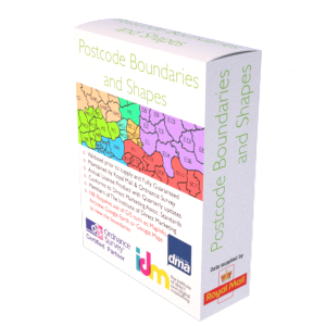
UK Postcode Sector, District & Area Property Counts (Residential & Business)
This instant download contains three product files, with circa. 11,248 Postcode Sectors e.g. 'OX7 5' (file 1), 2,979 Postcode Districts e.g. 'OX7' (file 2) and 125 Postcode Areas e.g. 'OX' (file 3), aligned to a count showing the number of...
Download Now
